16/32 位灰度 PNG/EXR 高程图生成器
一个基于浏览器的工具,用于从真实世界地形数据生成高质量的 16 位灰度 PNG 高程图或 16/32 位 EXR 高程图。
非常适合在 Unreal Engine 5 和其他游戏引擎或 3D 软件中创建逼真的地形,如 Terrain3d、Godot4 和 Blender。
🌐 官方网站: https://manticorp.github.io/unrealheightmap/

⚠️ 重要通知
我们开始触及部分地图服务的免费额度限制,因此网站可能无法使用,直到我们获得资金提升这些限制。如果您觉得此工具有用,请考虑支持该项目!
✨ 功能特色
- 高质量 16/32 位输出 - 生成具有 65,536/4,294,967,296 级细节的高程图(相比 8 位只有 256 级)
- 真实世界地形数据 - 使用来自 Mapzen 全球高程服务 的高质量高程数据
- 交互式地图界面 - 通过直观的地图界面可视化选择地形区域
- 多种归一化模式 - 可选择无归一化、常规归一化或智能归一化以优化高程图数据
- 灵活的输出尺寸 - 提供 Unreal Engine 预设尺寸或最大至 8129×8129 像素的自定义尺寸
- 基于浏览器 - 无需安装,完全在您的浏览器中运行
- 实时预览 - 在地图上叠加显示您导出的区域
- 复制与粘贴坐标 - 支持多种坐标格式,包括度分秒和十进制度
🎯 适用场景
- 为 Unreal Engine 5/Blender/Terrain3D 地形创建逼真地形
- 利用精确真实地形进行游戏开发
- 3D 建模与可视化项目
- 地理信息系统(GIS)应用
- 教育和科学可视化
🚀 快速开始
- 访问 https://manticorp.github.io/unrealheightmap/
- 使用地图导航至所需位置或手动输入坐标
- 调整输出缩放和尺寸以定义导出区域(以橙色矩形显示)
- 选择适合您用途的归一化模式
- 点击“生成”以创建并下载您的高程图
📖 文档
🛠️ 技术栈
- TypeScript - 类型安全的应用代码
- Leaflet - 交互式地图界面
- jQuery - DOM 操作和 UI 交互
- UPNG.js - PNG 编码/解码
- Pako - 数据压缩
- Webpack - 模块打包
- Bulma - CSS 框架
- SASS - CSS 预处理
💻 开发环境搭建
前提条件
- Node.js(推荐版本14或更高)
- npm(随 Node.js 一起安装)
安装
# Clone the repository
git clone https://github.com/manticorp/unrealheightmap.git
cd unrealheightmapInstall dependencies
npm install
构建命令
# Development build
npm run buildProduction build
npm run authorWatch mode (auto-rebuild on changes)
npm run watchRun unit tests
npm test
项目结构
├── src/                   # Source TypeScript and SASS files
│   ├── app.ts             # Main application logic
│   ├── main.ts            # Entry point
│   ├── png.ts             # PNG processing
│   ├── processor.ts       # Web worker for image processing
│   ├── sass/              # Stylesheets
│   └── templates/         # HTML templates
├── public/                # Static assets and build output
│   ├── dist/              # Built JavaScript and CSS
│   ├── im/                # Images
│   └── examples/          # Example heightmaps
├── index.html             # Main application page
├── instructions.html      # Documentation page
├── examples.html          # Examples page
└── webpack.config.js      # Webpack configuration
🎨 示例
大峡谷 (64公里)
在工具中查看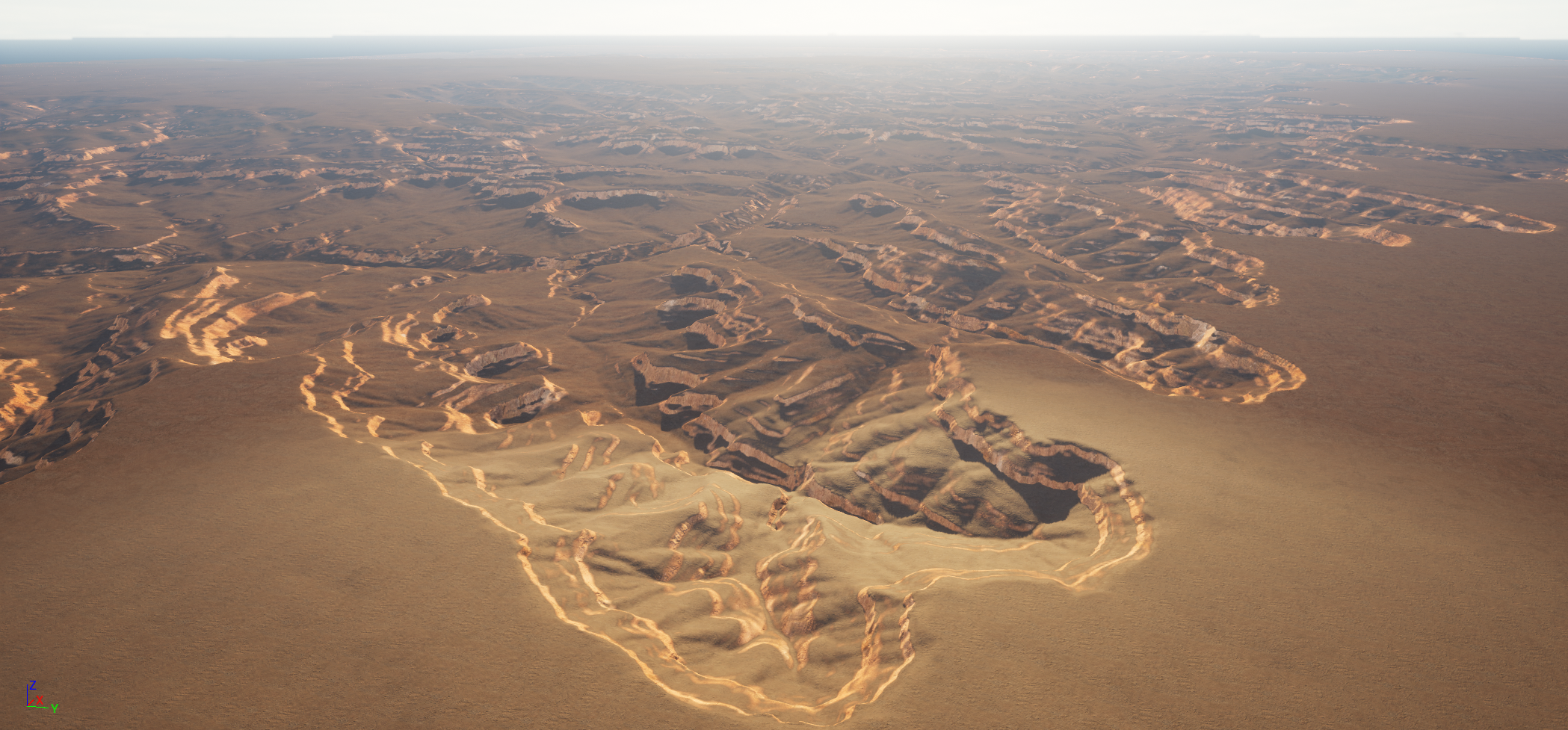
更多示例,请访问示例页面。
🔧 归一化模式
无
不进行归一化。像素值直接表示高度(米),负值设为0。常规
将高度值缩放至整个16位范围(0-65535),最大化整个高程图的细节。智能
一种高级模式,处理数据错误和异常值。使用99.9%的窗口过滤极端值,同时在1个标准差内保留真实的最小/最大值。📊 输出格式
- 格式: 16位灰度PNG,16位EXR或32位EXR
- 位深: 65,536个细节等级(2^16)或4,294,967,296(2^32)
- 精度: 可表示珠穆朗玛峰(8849米),间隔约13厘米(16位)
- 源数据: Mapzen高程数据(24位精度,约4毫米精细度)
🤝 贡献
欢迎贡献!请随时提交问题,分叉仓库并创建拉取请求。
📄 许可证
本项目采用MIT许可证 - 详情请见许可证文件。
高程数据由Mapzen提供,可能有其自身的许可条款。
💖 支持
如果您觉得这个工具有用,请考虑支持该项目:
- ☕ 在 Ko-fi 上请我喝咖啡
- ⭐ 给这个仓库加星
- 🐦 分享给可能觉得有用的其他人
🙏 致谢
📞 联系方式
- 作者: Harry Mustoe-Playfair
- 邮箱: harry.mustoeplayfair@gmail.com
- GitHub: manticorp
为虚幻引擎、3D 和游戏开发社区倾心制作 ❤️
--- Tranlated By Open Ai Tx | Last indexed: 2026-01-10 ---